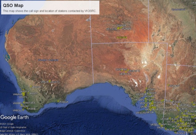
QSO Map Pyton Script
By VK3FOWLThis project is a python program used to plot the location of QSOs (radio contacts) on Google Earth or other mapping applications. It reads an ADI file of the QSOs and creates a KML file
Hits: 114 | Votes: 0 | Rating: 0.00
Resource Details
You will find this resource in just one category on our links directory. The title of the main category is Developer Resources and it deals mainly with Ham Radio Developer Resources. The resource has been on our site since Monday Aug 30 2021, and it has been viewed 114 times. So far no one has rated it yet. Be the first to rate it!Rate this resource
no one has rated it yet. Be the first to rate it!
The scale is 1 - 10, with 1 being poor and 10 being excellent.
Webmaster, add a Remote rating
Link not working?
Occasionally, links may expire, move, or become outdated. If you've encountered a problem, kindly Report it here. We'll promptly look into the issue and update the link if possible. We appreciate your feedback!More Like This
If this particular resource doesn't quite meet your needs, don't worry! In the same category, you'll find several other links that may be equally interesting and relevant to what you're looking for. We encourage you to explore these additional options, as they might offer the insights or information you're seeking.- How to calculate Bearing and great-circle distance between two points - Calculate distance, bearing and more between Latitude/Longitude points...
- FCC Callsign Database Script - This is a Bourne Shell script that will automagically download the FCC...
- How to use AI to identify Radio signals - How to use AI (Artificial Intelligence) to identify Radio signals usin...
- FT-817 CAT library - Serial CAT interface to control a Yaesu FT-817 transceiver. Inspired...
- CQ Zone, ITU Zone and Maidenhead Locator to your leaflet maps - Open source code to add CQ Zone, ITU Zone and Maidenhead Locator to yo...